RISING SEA LEVELS at CROKER ISLAND

Greetings from Croker Island, NT.

Recently we have experienced some very high tides around Croker Island. Numerous elders have commented to the rangers that they do not recall the sea water ever being as high. Below - a photo of a casuarina tree with most of its roots exposed. The floodplain mentioned later in this post is just just on the other side of the trees on the left of this photo. 


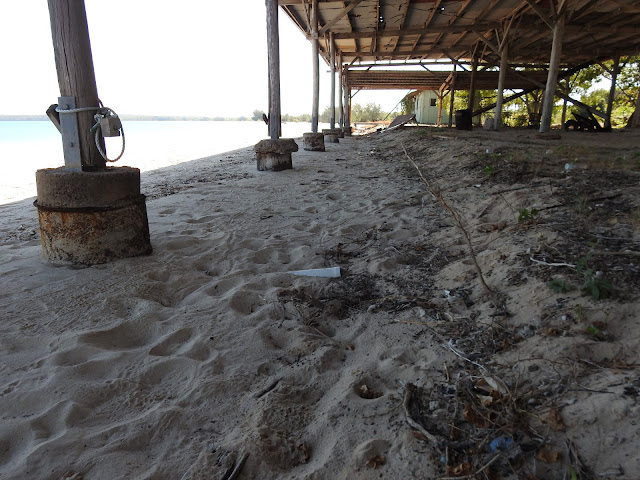
At the southern tip of Croker Island is an abandoned pearl farm. The high tides have entered the work area and have eroded the sand from around the front line of posts.

In the north of the island a sign fell over after the sand it stood in was wash away.

Smaller casuarina trees have died and toppled into the water.

Others are close to toppling. 

It was rather timely that we had a visit this week from a scientist wanting to research areas that may have been covered by salt water in the past when sea levels were higher than they are today. The Google Earth image below shows the main floodplain area on Croker Island with the beach in the top left corner. The lines on the floodplain running roughly parallel to the beach are where the beach or coastline was many years ago. 

The next image shows a line from the beach extending right up to the top end of the floodplain. Below the image is an elevation profile along this line. The left hand end represents the area nearest the beach and shows these old sand dunes where the coastline was many years ago. What surprise me when I saw this elevation profile was that it will only take a small rise in sea levels for this floodplain to be permanently flooded with salt water.

The scientist are drilling core samples around the floodplain and then by analysing these samples they can identify what animals and plants have lived here and at what times in the past. They are also seeking to hear from the older residents here what changes they have noticed in their lifetimes or maybe have heard stories of changes from previous generations. We took some older women out to clay pan near a creek this week. The women hadn't been to this area for some years. They were surprised to see the clay pan is now nearly all covered with mangroves - a strong indication that salt water is coming further inland than it used to. 

It appears that rising sea levels is not just something that happens in low lying islands in faraway places. 

Cheers for now

Bryan


Comments

Popular posts from this blog

KRISTY and DEAN'S WEDDING

A CROCODILE and an ANTLION - the Big and the Small