THE SIMPSON DESERT - DALHOUSIE SPRINGS to POEPPEL'S CRONER
Hi again
Leaving Dalhousie Springs heading east, the first part of the Simpson Desert or Munga-Thirri National Park is fairly flat with no sand dunes. The photo below, not far from Dalhousie Springs reminded us a little of the Painted Desert area west of Oodnadatta.

About 4 kms from Dalhousie there is a rubbish dump (so as not to attract dingoes to the Dalhousie camp ground). Here we noticed a water leak from the engine area. This was definitely not a welcome sight when we were about to head into the Simpson Desert. Fortunately our repairs were effective.

The evidence of recent rains in the desert.

Purni Bore, located in Witjira National Park, South Australia, is a significant landmark with a history tied to oil exploration and the creation of an artificial wetland. Originally drilled in 1964 by the French Petroleum Company to explore the Great Artesian Basin, the bore was initially intended to be capped and sealed. However, due to corrosion of the wellhead, it began to flow, creating a unique wetland environment.
In time, the flow from this bore began to impact the Dalhousie Springs, so the flow of Purni Bore was
restricted.

The flies were very numerous and very friendly here.

The shortest and most direct route across the Simpson is via the French Line and then the QAA Line in Queensland. It also has the most traffic on it. The French Line is the track straight ahead in the photo below. We decided to drop down further south to the Rig Road which flows into the WAA Line - to the right in the photo below.

The Hema map below shows our track highlighted from Dalhousie Springs to Purni Bore then down to the Rig Road and WAA Line. Unfortunately the eastern end of the WAA Line was impassable so we have to back track a little and return to the French Line via the Erabena Track.

Having a flag mounted on our vehicle is mandatory (and good safety). As you will observe in the videos of our sand dune crossings in this blog, as we crest each dune we are driving completely blind to opposite direction traffic. The flag gives each driver a little warning. We did not have any close calls.
Our camp on the WAA Line. In the photo below, can you see our vehicle and camp down on the flat area between the dunes?
As far as we can see in every direction there are dunes after dunes - looking to the south east below.

The sunset on the WAA Line - looking to the north west.

And looking to the south.

Another night in the Simpson. The nights and early mornings were cold but the days were pleasant. Some mornings it was a struggle to climb out of the swag!

Some cloud came over during the night and made for a beautiful moon rise.

Below is an image from the Vera Rubin Observatory in Chile which has just began scanning the southern skies with a new telescope and digital camera. In just a short time it has observed many previously unknown celestial objects. Camping in the Simpson Desert makes one feel very small. Looking up into the central Australian night skies only makes one feel even smaller - yet at the same time, deeply awed and moved. I was reminded of some related verses from Psalm 19:1- 4.
- The heavens declare the glory of God, and the skies announce what his hands have made.
- Day after day they tell the story; night after night they tell it again.
- They have no speech or words; they have no voice to be heard.
- But their message goes out through all the world: their words go everywhere on the earth........
Observing our physical world, away from the clutter and 'noise' of the world can be a deeply spiritual experience.

The morning star (Venus) is already well above the eastern horizon as a new day in the Simpson dawns.

For a remote area, this is quite a busy aviation 'highway'. Some vapour trails scribe across the early morning sky.

Our WAA camp from the same sand dune that the photos from last evening were taken - now in the morning light. Our little camp can be seen a little easier - still very small in the landscape!

Looking to the north along the east face of this dune.

As we progress east, the sand dunes are getting higher and steeper ....
........ requiring the tyres pressures to be lowered. This creates a larger footprint on the soft sand helping the tyre to float across the surface instead of digging in and probably bogging.
Another dune crossing ........
In between the dunes there were stretches of track that were rather wave like - requiring a steady pace in second gear.
Even though humans only visit the Simpson in the cooler months, there are many other creatures and plants that call this place home. Observing the tracks of these creatures is often a better way to learn who is about. Below a camel track.

And an emu track.

Below a dingo track. We also heard their howling at night at a few camps.

Below at the top is a human track - mine. But look a little closer and observe the lots of smaller tracks - small birds, mammals, skinks and lizards etc.

And someone's freshly made home in the desert.

As mentioned earlier, the WAA Line was impassable so we had to return to the French Line. The next night we camped near Lake Tamblyn amongst some giddy trees. Gidgee produces very hard wood which makes for great fire wood.

Lake Tamblyn as the sun sets on another day.

While having breakfast the following morning we had a visitor - a female dingo. She was obviously very comfortable with humans but showed no aggressiveness. Firstly, observing from about 100 metres.
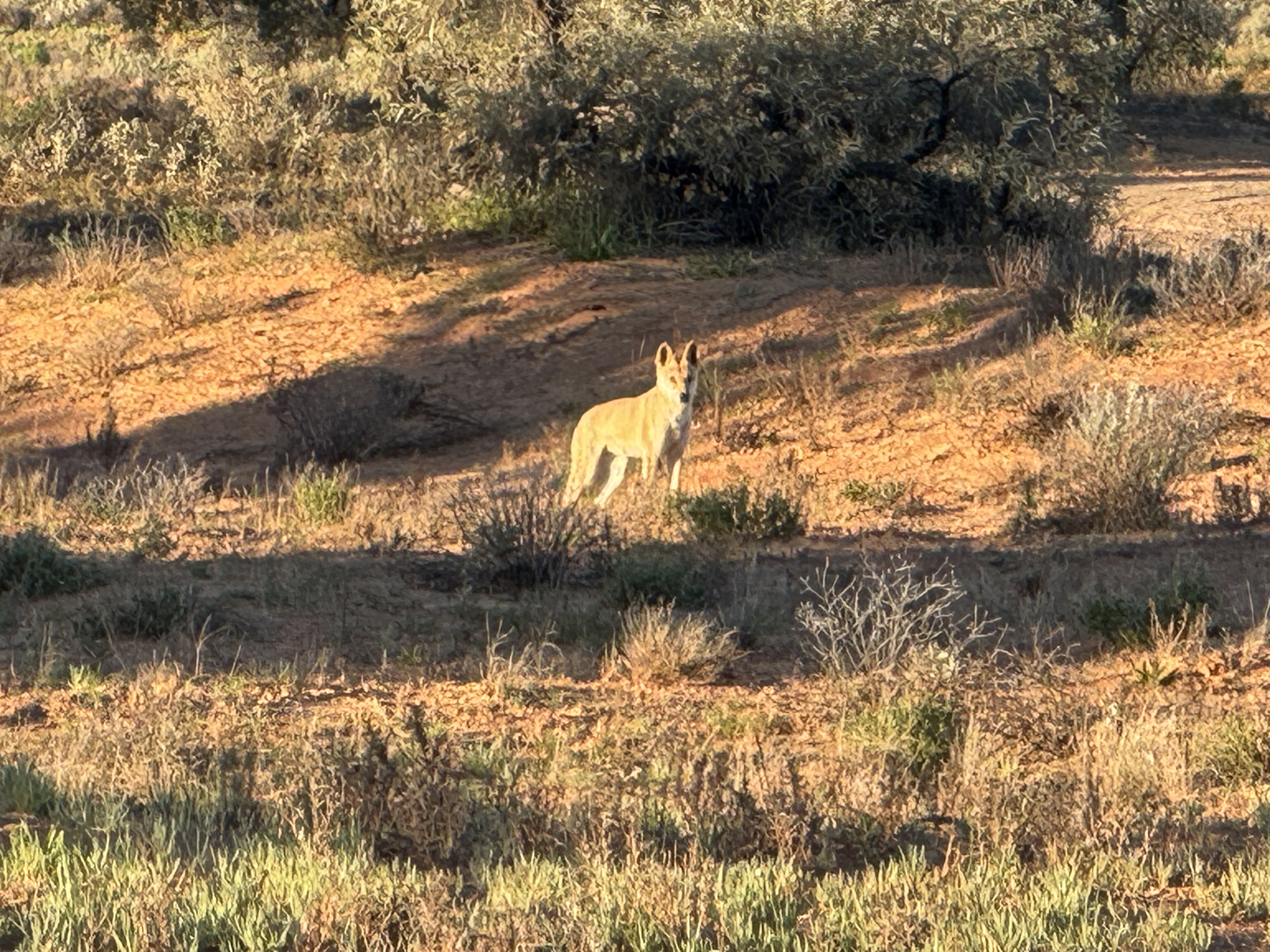
And then casually strolling passed our camp to take up another sunny position. It seemed like she had done this before - waiting for campers to move on and hoping to score some food scraps.
She allowed me to get to about 15 metres from her before slowly moving away. When I stopped, she stopped and looked back - as in the photo below.
As soon as we did break camp, she headed straight in to investigate - she would have been disappointed. As in other places, in the Simpson Desert there are warnings about not feeding the dingoes.

The Gidgee trees in the Simpson are much shorter compared to further east. They were starting to flower in some places, adding to the colour of the red sand and a big blue sky.

The Gidgee tree flowers have their beauty however the trunk of this tree had a different kind of beauty - aged and weathered but still thriving in this place of extremes.

We left our dingo friend and camp amongst the gidgee trees and continued east to Poeppel's Corner. This is where the borders of South Australia, the Northern Territory and Queensland meet - see the Hema map below.


Peoppel's Corner is in the distance in the photo below however after some photos we had to take another detour.

In the next blog we make it to Big Red, the well known big red sand dune west of Birdsville and then onto Birdsville - and a hot shower.
Until then, take care.
Bryan and Nancy


Comments