ALICE SPRINGS to MT DARE HOTEL to DALHOUSIE SPRINGS
Hi again
As we had not planned to do the Simpson Desert crossing we had to stock up on the food and camping gear in Alice. Once this was done, we headed off on a fine central Australian winters day, passing the Alice Springs Airport and onto the community of Santa Teresa. We were following the Binns Track (the highlighted track to the right or east of the map below).
The community of Santa Teresa is nestled in beside some rugged hills - see photo below. We had never previously visited Santa Teresa however I recalled one sad story related to this community.
One of the Garngi rangers who I worked with while at Croker Island is a descendant of a 'stolen generation' person. Her grandfather and sister came from Santa Teresa however as their father was non-indigenous this meant that they were of mixed descent. The government policy in the 1940s and 50s dictated that indigenous children of mixed descent had to be taken from their parents - usually an indigenous mother (the non-indigenous father had usually long since moved on). Many were taken to far away places - one being Croker Island. Aware of this policy, the mother of these two children headed north managing to keep one step ahead of the government officers. Unfortunately, they were caught near the Wauchope Roadhouse on the Stuart Highway south of Tennant Creek.
As the government officers were too lazy and/or arrogant they did not learn the indigenous names of these children so gave them European names - in the case of the Garngi ranger's grandfather, James Wauchope. The surname came from the area where they were caught (Wauchope Roadhouse). Sadly, this sad story was repeated many times across Australia through these decades.
The Santa Teresa church. This mission was established in 1953 after being moved from Arltunga to the north of Santa Teresa.
South east of Santa Teresa we travelled through pastoral leases. The cattle were in good condition after recent rain.
And then we passed through the western part of the Simpson Desert. Heading in a generally south, south easterly direction we were travelling parallel to the sand dunes.
The road through this area was reasonably well maintained resulting in good progress.
About 40 kms short of Old Andado Station we took a detour to the Mac Clark Conservation Reserve. This reserve protects some of the rarest trees in Australia - Waddywood (Acacia peace). Malcolm and Molly Clark lived and worked in this area for many years - hence the name of the reserve - Mac Clark.
Waddywood trees produce very hard wood which was used for fence posts. When the Clarks became concerned about their reducing numbers they pushed for the establishment of this reserve.
One of the reasons this tree can survive in such a harsh dry place is its needle like leaves which help to conserve moisture.
Our first camp in the desert.
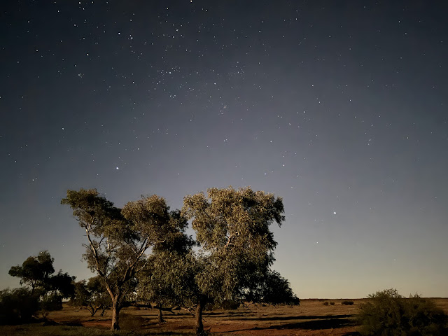
Sleeping under the Southern Cross - this must be one of life's great pleasures!
We were just past full moon in the lunar cycle which produced this almost 'daylight' photo taken at night.
The next morning we continued onto Old Andado Station. Molly Clark lived here for many years after Mac died. The homestead is now a tourist attraction - kept as close as possible to when Molly left.
The photo above was taken from on top of the sand dune in the photo below.
For those interested in some outback history, the link below tells some of the story of Old Andado Station and the Clarks.
Crossing the Northern Territory/South Australian border and also entering the Witjiri National Park.
After refuelling at Mt Dare Hotel we continued on to Dalhousie Springs, a series of over 60 natural warm artesian springs with a flow rate of around 17,000 litres per second. A very pleasant way to wash the dust off and relax after our journey.
The next morning the mist rising off the warm spring waters as the sun climbs above the horizon.
We were temped to stay a second night here however once the sun went down the mosquitos were numerous and rather 'unfriendly'.
So .... after another swim, we headed east towards Birdsville, normally 450 kms away if we took the most direct route on the French Line, however due to flooded areas there was also an extra 60 km detour in place around the Eyre Creek.
At the Dalhousie Springs there were many of these little fish who delighted in nibbling at our skin. It wasn't painful.
The next post will cover our trip across the Simpson Desert to Birdsville - during which we will be crossing many hundreds of sand dunes, not paralleling them as we had been most of the way so far, all with no services available.
Regularly we felt really 'small' in this vast place with wide, wide horizons.
Cheers for now.
Bryan and Nancy


Comments