Hi
Last weekend we flew into Darwin for the weekend. Laura was flying up to Darwin for a friend's wedding. She had not met niece Amelia yet so I think the wedding was more of an excuse.
Dean, Kristy and their little family.
Aunty Laura meets Amelia.
Granny and Pa with our grandchildren - a real blessing.
While in Darwin a friend from Inverness in Scotland was passing through Darwin. It was great catching up with Bev.
Trevor and Leonie were in town for the wedding. Leonie and Nancy met in the maternity ward in Gove hospital back in 1984. We have kept in touch even since.
Recently the Garngi rangers have been busy with our carbon abatement early dry season 'cool' burning. This involves both ground and aerial burning and if done well reduces the amount of carbon that ends up in the atmosphere. We receive some good income from this work.
For the aerial burning we use a Robinson R44 helicopter. The rear left door is removed and an incendiary machine is fitted in that space. The machine can be seen in the photo below. A roll of capsules is fed into the machine where each capsule is injected with glycol before being cut off. It then falls to the ground via the pipe coming out of the cabin and pointing downwards. A chemical reaction within the capsule starts - causing a fire about a minute later.
At the beginning of each day we test the machine with five capsules and need to see a 100% success rate of them igniting. The capsule are collected from the pipe and quickly taken to the nearby bitumen road - so as not to start a grass fire. All five ignited, so we were 'good to go'.
Helicopter safety is an important matter. While the rotors are rotating and with the pilot's approval we can approach the helicopter but from the front only - avoiding the dangerous tail rotor.
And it is time to depart on another burning trip.
Before any aerial burning happens, there is quite a bit of planning. Satellite technology plays an important roll these days. By looking at previous year's satellite imagery we can see what areas have burnt and what haven't.
Over our work area there is a wide range of different landscape from mangrove rivers and creeks with associated bare claypans, floodplains ringed by paperbark forests to savannah woodlands, small patches of rainforest to sandstone ridges with spinifex which all require different fire management. Scattered over the landscape are also building assets, Telstra towers and sacred sites that need to be protected from fire.
Some landscapes need burning every year while others only need to be burnt every 3-5 years.
Looking at the satellite image below, the tan colour represents the areas that burnt last year. From this we can see what areas need burning this year. We then setup routes on a navigation device to guide the helicopter pilot. The final results are represented by the blue and red dots and stars - showing recent fire activity.
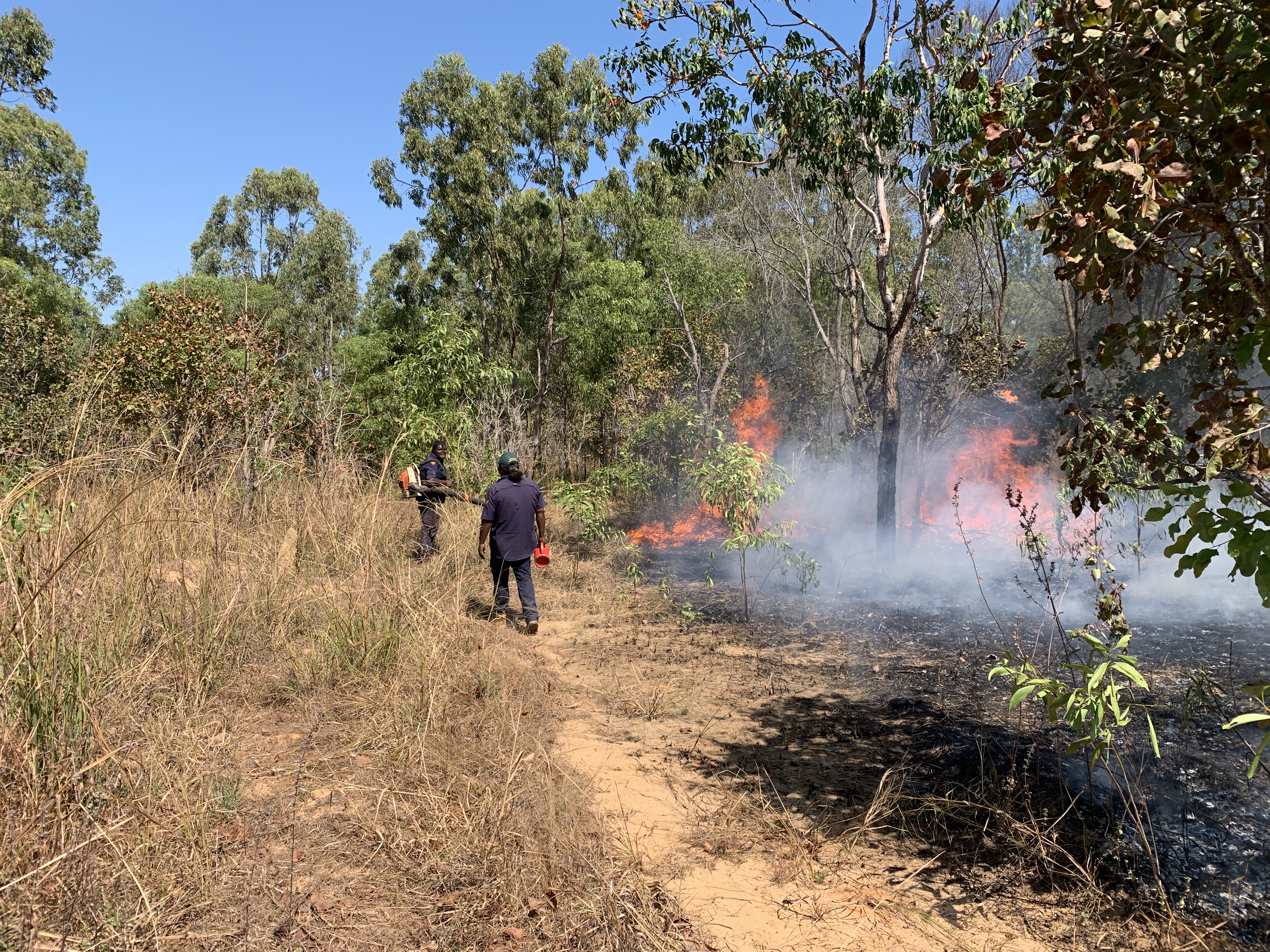
Below the rangers are conducting some asset protection burning around an outstation. A line of fire is set using a drip torch which uses a mix of petrol and diesel.
And then a powerful backpack blower is used to direct the fire and can even blow the fire back onto itself and 'kill it' - put it out. A very handy piece of equipment.
This year we were able to purchase a slide on fire fighting unit which has also been helpful in controlled fuel reduction burning. We can also use it as water supply when we are camping out.
July in the Top End is the best time weather wise. Little chance of rain, lots of blue skies, temperatures between high teens to low 30s and humidity much lower than it will be in a few months.
Until next time, take care.
Bryan and Nancy


Comments