Posts

Showing posts from 2025

SCENIC FLIGHT OVER LAKE EYRE Part 2 - William Creek, Coopers Creek, Goyder Lagoon, Big Red, Birdsville

Image
Hi Below are two videos of our scenic flight return leg from William Creek to Birdsville via Coopers Creek and Big Red. The photo is of part of the Goyder Lagoon floodplain. I had to spit this leg into two parts so as to upload to the blog site.  Take care Bryan and Nancy 

SCENIC FLIGHT OVER FILLING LAKE EYRE - Part 1

Image
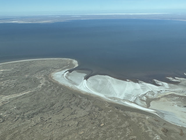
Hi again Nancy and I were very blessed to be able to take an amazing scenic flight recently from Birdsville down the Diamantina River, across the Goyder Lagoon floodplain, down the Warburton River then across Lake Eyre North before turning west to William Creek for a short break. Big rainfalls earlier in the year resulted in this, normally dry barren desert turning into a sea of water and green. After the break and refreshments we returned to Birdsville via a different route - that will be covered in part 2.  My amateur video below is part 1 of this scenic - Birdsville to William Creek. I had to reduce the quality to upload the video so it will look great on larger screens.  If ever you have the opportunity to take this scenic flight at a time when Lake Eyre is filling, I am sure you will not be disappointed.  Part 2 coming shortly.  Blessings Bryan  

A DAY IN BIRDSVILLE

Image
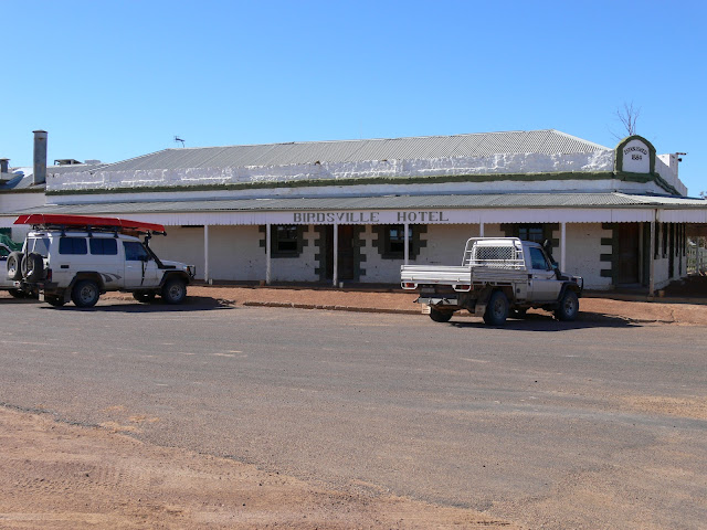
 Hi again I spent some of my early years living near Chinchilla on the western Darling Downs in Queensland. It always puzzled me that people from Brisbane would refer to Chinchilla as being 'way out in western Queensland'. There used to be a T shirt promoting Chinchilla which had the words 'Chinchilla - Just East of Too Far West'. Chinchilla is just 250 kms from Brisbane yet around 1400 kms to the western Queensland border (135 kms west of Birdsville). So Chinchilla is actually still in south east Queensland!  My first visit to Birdsville was in December 1988, flying in a little Piper Comanche on my new private pilot's licence. In those days, before the terrorist attacks in America during September 2001, there were no high fences and coded gates at airports so one could park the plane directly opposite the Birdsville Hotel, refuel the plane and then walk across the road and 'refuel' the pilot and passengers.  Like a lot of western Queensland towns back then,...

SIMPSON DESERT - POEPPEL'S CORNER to BIG RED and BIRDSVILLE

Image
Hi once again Continuing our trip across the Simpson Desert (Munga-Thirri Desert NP), we headed north from Poeppel's Corner for about 20 kms before turning east again along the QAA Line. As we move eastward the dunes continue to get larger. The photo below shows this. Nancy and I have done quite a lot of long distance driving across Australia over the years. For some time now we have enjoyed listening to audio books while driving these long, lonely roads - the kilometres seem to pass quicker.  In the video below, of another dune crossing you can hear the latter part of Peter FitzSimon's book, 'Ned Kelly' playing in the background - an excellent read/listen.  The further east we travel, the more surface water we come across - requiring yet another detour.  Increased rainfall in the desert means wildflowers. Despite the colder weather the blooms were starting to come out. There were also lots of buds so in a few weeks there will be lots more colour in the desert. Below ar...

THE SIMPSON DESERT - DALHOUSIE SPRINGS to POEPPEL'S CRONER

Image
Hi again Leaving Dalhousie Springs heading east, the first part of the Simpson Desert or Munga-Thirri National Park is fairly flat with no sand dunes. The photo below, not far from Dalhousie Springs reminded us a little of the Painted Desert area west of Oodnadatta. About 4 kms from Dalhousie there is a rubbish dump (so as not to attract dingoes to the Dalhousie camp ground). Here we noticed a water leak from the engine area. This was definitely not a welcome sight when we were about to head into the Simpson Desert. Fortunately our repairs were effective.  The evidence of recent rains in the desert. Purni Bore, located in Witjira National Park, South Australia, is a significant landmark with a history tied to oil exploration and the creation of an artificial wetland. Originally drilled in 1964 by the French Petroleum Company to explore the Great Artesian Basin,  th e bore was initially intended to be capped and sealed.  However, due to corrosion of the wellhead, it began ...