Posts

Showing posts from March, 2023

CROKER ISLAND - BEACHES, CLIFFS, REEFS and SEA GRASS

Image
Hello from Croker Island Earlier this week we had a significant rain event here measuring 185 mm over a 24 hour period. We had an anthropologist here from Darwin to do some registering work on sacred sites around the island. The rain impacted some of our plans earlier in the week however on Thursday the weather had improved, allowing us the get out. The visibility was amazing! But first, a short explanation of what a sacred site is. There are many different types of sacred sites from burial sites, to clan boundary markers to restricted areas like a no fishing marine park. Additionally, as Indigenous people were and still are to a large extent an oral culture, stories are passed on from generation to generation about people, land and marine animals and birds travelling through the land. Many of the locations in these stories are also sacred sites. These stories were told to children at night as they prepared for sleep. Most of these stories also have deeper layers of meaning which can i...
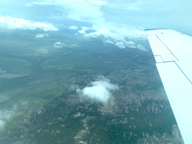
KAKADU AND NITMILUK NATIONAL PARKS from the AIR in the WET SEASON

Image
Hi again Last week I travelled to Katherine to attend an Indigenous ranger conference. We travelled by a light charter aircraft - a Beechcraft Barron.  Come with me for a scenic flight over the Top End of the NT? We flew from Croker Island to Goulburn Island first to picked a ranger there before tracking over north west Arnhem Land and then western Kakadu National Park and onto Nitmiluk National Park before landing at the RAAF's Tindal Base near Katherine. Western Arnhem Land and Kakadu NP share a common boundary which for the most part runs through rugged sandstone country - see below. Our charter flight had been delayed for five hours due to weather - the remains of a low pressure system that had moved slowly over to Queensland. As the photo below shows, there was still lots of clouds around and some rain.  Not good forced landing country down there! During the wet season, the rivers in this area are all pumping. As we enter the Nitmiluk NP, we fly over m...

RISING SEA LEVELS in NORTHERN AUSTRALIA

Image
X Hi again In previous blog posts I have mentioned our observations of rising sea levels around Croker Island.  Regularly we are seeing scenes like the photo below where higher tides are eroding coastal casuarina trees. Many have fallen over and died.  I have to admit that I have found these scenes concerning so have been doing some investigation of my own.  The graph below shows the average sea level risings around the planet using information from many sea level measuring sites.  Unfortunately for many areas, including northern Australia, sea levels are not rising evenly. Some areas are rising several times quicker than others. Most will have seen videos of ice shelves and glaziers melting which contributes to rising sea levels. However apparently, there is more to this story than just meting ice. The oceans are absorbing around 90% of the increased heat energy caused by global warming and the rate of this absorption has been increasing over recent decades. Underst...